Plane
Route
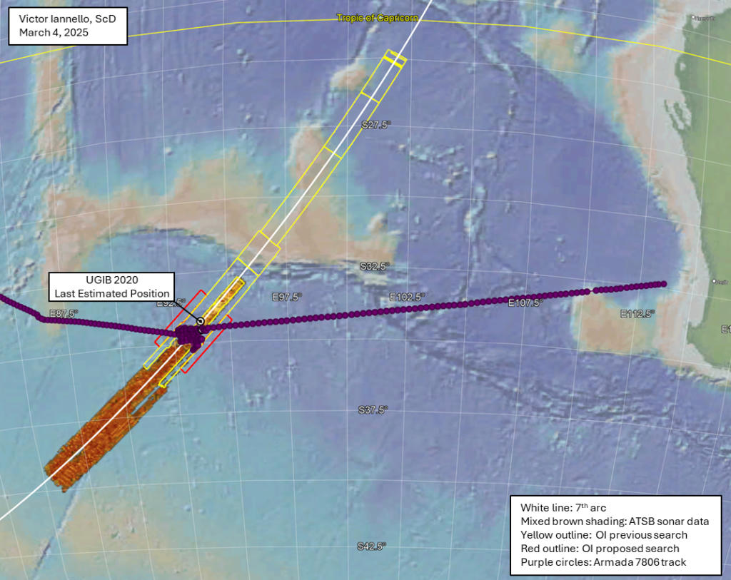
Filed KUL–PEK. Flown, after IGARI, west across the peninsula and out of primary radar, then — on the SATCOM reading — south into the Indian Ocean. The 7th arc is a range ring, not a crash coordinate.
Schematic · not navigational
7th arc, debris, search boxes
Kuala Lumpur International Airport
Departure · 16:42 UTC 7 March 2014
Waypoint IGARI
FIR boundary · Gulf of Thailand
Penang
Westbound primary-radar track · FO phone register
Andaman Sea / last primary radar
18:22:12 UTC
7th arc (schematic locus)
00:19 UTC range ring from Inmarsat I-3
ATSB underwater search box 2014–2017
~120,000 km² · suspended 17 January 2017
7th arc (schematic locus)
00:19 UTC range ring from Inmarsat I-3
Andaman Sea / last primary radar
18:22:12 UTC
ATSB underwater search box 2014–2017
~120,000 km² · suspended 17 January 2017
Daghatane / Mozambique coast
Flap-track fairing and other almost-certain pieces
Diego Garcia
British Indian Ocean Territory · collection-geography question
Greenville, Texas
BIG SAFARI short-term storage · Blue Devil II hardware
Gulf of Thailand / South China Sea search
Wrong-ocean SAR · 8–14 March 2014
Îlot Bernache, Mauritius
Confirmed left outboard aft flap · 10 May 2016
Kuala Lumpur International Airport
Departure · 16:42 UTC 7 March 2014
Mossel Bay, South Africa
Engine-cowl fragment with Rolls-Royce marking
NAWS China Lake
Orion first flight · 24 August 2013
Ocean Infinity 2018 corridor
~112,000 km² along a revised arc
Ocean Infinity 2025–27 priority box
15,000 km² · 7,571 surveyed · 7,429 remaining
Pemba Island, Tanzania
Confirmed right outboard flap · 20 June 2016
Penang
Westbound primary-radar track · FO phone register
Saint-Denis, Réunion
Flaperon find · 29 July 2015
Southern Indian Ocean
Search theatre after 15 March 2014
Waypoint IGARI
FIR boundary · Gulf of Thailand